Showing posts with label Dover. Show all posts

Saturday, 19 January 2013

Safe havens with touches of yellow


You would think this yellow French letterbox would be a safe have for all your mail, but at times it isn't so safe.  I took the photo because it's an old style of letterbox, one you don't see around as often these days, but later I read the black label above it.  It marks the level of the flood on 5 October 1960.  There must have been some very soggy post that day.


Next a safe haven for swimmers on the Ramsgate beach.  That day nobody in their right minds would have been swimming but the lifeguards put out their yellow banner just the same.  A small group of hardy souls sitting on the sands made it worthwhile.


A real safe haven in Dover Eastern Docks where the kerbs and bollards are painted yellow.  The cross channel ferries follow each other out of the harbour entrance.


At the time of taking the photos that same harbour entrance was used for the cruise liners that dock at Western Docks.  The second entrance was being cleared enough to allow the cruise liners through.  During the war this western entrance had been blocked and though re-opened in 1963, needed more dredging to allow larger ships through.

The two liners to the left have the yellow funnels of Saga cruises.  The smaller one is, I think, the Spirit of Adventure which was chased by Somali pirates in 2011.


A two-in-one post for the Photo Hunts. 


Enhanced by Zemanta

Thursday, 19 July 2012

A dry squib


Yesterday evening the Dover area was damp, very damp, but the Olympic Torch arrived nevertheless.  It went into the Channel Tunnel, it went for a short ride on a tall ship, and it ended up at Dover Castle for a firework display.  It was a shame it was so damp.  Some people noticed the lights over the castle and thought it was a thunderstorm.

In spite of the weather forecasters spreading doom and gloom, today dawned bright and sunny so the crowds gathered for the next leg of the torch relay.  Outside my window, near enough.


In spite of trying, I couldn't ignore them so I had to join them.  I got a good spot by the side of the road.  I waited.


The police came by.  I waited.


I looked at the flags.


One dog had had enough.


The police came by again.  At this point the police had been past at least six times.  I'm sparing you some of the detail.


Then we had the bus.  It either did several circuits or there were several buses.

I'll have to skip some more or it will take all night.  After a whole fleet of assorted yellow/orange buses and cars passed by, we got The Sponsors.  We had Coca Cola, Samsung and Lloyds TSB, all very loud and cheery.


And we waited.


And talked amongst ourselves.


Then there were more police, more yellow/orange vehicles and suddenly ....


 ... a runner.  I blinked and almost missed her.  Who the other runners were, I've no idea.  They appeared from time to time between the vehicles.

So then we all went home, most of us.


Some forgot where they were going...


And others, well the air was full of the promise of bacon.... sausages.... eggs....


In spite of myself, I enjoyed the morning. 

Enhanced by Zemanta

Friday, 30 March 2012

Moving along (the cliff)

Further around the coast and just beyond Dover, you come to Langdon Cliffs owned by the National Trust.  I have always resolutely turned my back on this because it seemed somehow very wrong to have to pay to walk along the coast.  I take it all back now.

I did have to pay to park the car but had I been on foot there would have been no charge.  Of course there is nowhere remotely close by for parking at the Dover end of the cliffs.  Maybe there is further along but that I don't know.  A nominal fee of £3 isn't exorbitant in any case so I was perfectly happy, the facilities provided are good (lovely cakes!), and the cliffs are well maintained.

The car park, part of it anyway, over looks the cross channel Eastern docks at Dover.  There is something mesmerising about watching the ferries arrive, manoeuvre into position, disgorge passengers and freight, re-load and depart, only to have the berths re-occupied within a very short time.


But I was here to see the cliffs so off I trotted.  Not too fast because the paths, which were on at least three levels, were really quite rough and really quite close to the edge....


There were warning signs up about the recent landslip but that seemed rather like shutting the door after the horse had bolted.  The result of the slide was easily visible from quite a distance.


Neither that nor the signs stopped people from looking closely.


I didn't notice anyone until I was going through these photos at home, and I've had to zoom as much as possible.  If you click on the picture you should be able to make out a few foolhardy souls who had gone for a closer inspection of the landslip and appeared to be standing right on the edge.

The area is a Site of Special Scientific Interest because of the varieties of flora and fauna to be found on the chalk grassland.  To maintain the grassland, the National Trust has brought in a number of Exmoor ponies to graze the land and keep over-vigorous grasses under control.  The ponies looked at me with some suspicion but didn't run away.


I imagine they would soon move if anyone approached too closely but I don't know how tame they are.  There are notices asking people not to feed the ponies.

The views are superb:


over the cliff tops


towards Dover Castle


and to the rocks below.

On a clear day, of course not this day, you should be able to see France.

The protected area continues over the cliffs to South Foreland Lighthouse and St Margaret's Bay, a route I'm saving for another day.

Sunday, 25 March 2012

Lost in the mists

Recently, although the days have been beautifully sunny, early mornings have been misty and the mists have lingered over the sea.  When I went to visit the Battle of Britain Memorial site near Folkestone, it was sunny and warm so it wasn't until I had a look over the cliffs to see the view that I realised how much the mist remained even at midday.


That is the view towards Dover with the train line running at the base of the cliffs.


A year ago I travelled along that line and managed to take a picture from as the train, the high speed one, passed along.  it can't have been travelling too fast at that point and, given how near the sea is, I'm quite glad it wasn't.


The view towards Folkestone.  In the days when there was a cross channel ferry running from Folkestone to Boulogne and Calais, the London train used to finish at the harbour arm you can see there in the distance.  The luxurious Venice Simplon Orient Express stopped there for about twenty years, before changing route to Folkestone West.


Not all the cliffs are white.  I have little to no knowledge of geology, but the red earth looks to me like the presence of an iron ore.


The North Downs Way passes right along this cliff top, and in places they seem to be encouraging you to walk over the edge.  The chalk cliffs are very prone to collapse and just last week there was a considerable fall just on the far side of Dover.  I'm rather glad there isn't a guard rail all the same.  It would ruin the feeling of the wide open space.

Possibly not the place to go if it really is misty.


Thursday, 18 November 2010

Samphire Hoe

Samphire: corruption of the French Saint Pierre.  an edible plant sometimes called sea asparagus.  It doesn't taste in the least like asparagus but it's delicious.  In France it's salicorne, or Salicornia, though in the UK it's a different species entirely, rock samphire,  growing on cliffs and mentioned by Shakespeare in King Lear: "Half-way down, Hangs one that gathers samphire; dreadful trade!".

Hoe: a piece of land that juts out into the sea.

Samphire Hoe:  a piece of land reclaimed from the sea using the spoil from the excavation of the Channel Tunnel and officially opened to the public in 1997.  It is the newest part of Kent, between the famed White Cliffs and the English Channel just to the west of Dover.


This wonderful location provides peace and quiet, walking and wildlife.  This view is to the east, towards Dover.


In this view to the west you can see the main line railway to Dover as it follows the base of the cliffs, disappearing into it from time to time.  It's actually quite a spectacular train journey at times, right on the edge of the sea.


In order to reach Samphire Hoe, you have to go through this tunnel.  To the left you can just sea the rail tunnels.  To the right are the works for Eurotunnel.


The west beach, a shingle or pebbled beach, gives a view of Folkestone.  Unlike Deal beach, it's quite rocky at low tide and would merit further investigation.


A good view of the sea wall construction.  It consists of two rows of sheet piles driven into the sea bed, the space between the two walls being filled with concrete.  On the outer edge boulders are piled up to stop the sea from undermining the base of the wall.


Material was placed behind the walls and topped with concrete slabs to create terracing.  This allows the water to run off and out through the drainage gaps on the lip of the sea wall.  The round concrete blocks on the wall provide access to the site drains.

I fondly imagined the terracing was intended to view spectacles out at sea or in Folkestone, firework displays or something similar, until I read one of the several information placards which told me the more mundane truth.


 This one described some of the birds I didn't see.  There were plenty of gulls though.


Somewhere halfway up this cliff is where the samphire grows, they say.  I didn't try to find out.  The little hut or shelter at the top is, I think, a view point from the North Downs Way which runs along the top of the cliff.  I'll save that one for another day.


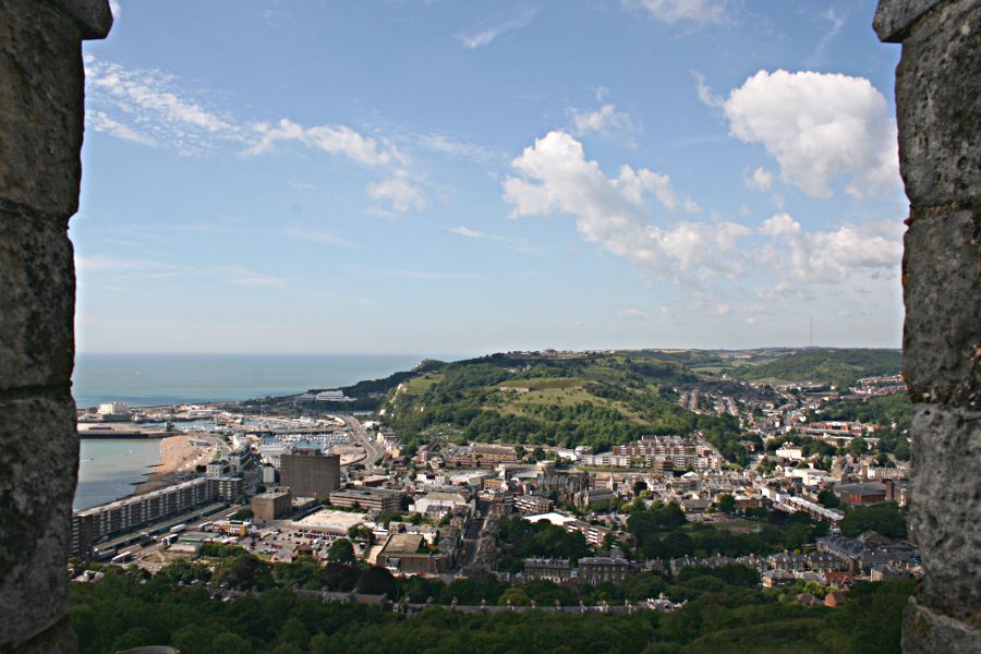
This was the view from the road on the way home.  The cliff straight ahead is Shakespeare Cliff with Samphire Hoe below and to the west.  Dover harbour is straight ahead with one of the cross channel ferries about to leave.

Who would believe, on a day like this, that just a few days earlier the wind was so strong that they considered closing the harbour for a time.
Enhanced by Zemanta

Tuesday, 17 August 2010

From the White Cliffs


The White Cliffs seen from the lookout at Dover Castle, but this isn't about the White Cliffs themselves, just the view from them.


If you were to follow the cliffs around, you would end up in St Margaret's Bay. There is a hair-raising road down to the bay, or a hair-raising pathway. Take your pick.


The main ferry terminal for cross-channel routes. It didn't look terribly busy that day, but of course it was mid-week and the summer season will soon be drawing to a close.  On occasions, mainly if something is going wrong, you can get queues of cars and lorries just waiting to get into the docks area, either all the way down that sloping road, or right through Dover itself.  Best not to venture out on those days.


Although it looked busy enough, some of the ferry operators are struggling. From Dover you can cross to Dunkirk (Dunkerque), Boulogne or Calais.


Looking over Dover and the western docks from the top of the castle keep. There is now a terminal for cruise ships, as well as marinas. Much of Dover had to be rebuilt after WWII.


Another view from the castle keep, this time showing the Western Heights, considered to be some of the most impressive fortifications in Great Britain.  It is asking for a visit of its own. Any day now.
Enhanced by Zemanta

LinkWithin

Blog Widget by LinkWithin